Wednesday 28 December 2016

September 9th: After lunch, we experience a Broch and a Henge


There are at least 50 brochs in Orkney and, alas, I can't exactly remember which one this is. My best, and likely correct, guess is the Broch of Gurness.

In any event, a broch is a fort. There is some question about who was being defended against. Some said the Romans, but that theory has been debunked by other scholars who say they were built as a result of more localized feuding over scarce land or perhaps just as immense status symbols. 

Most were built between 600 BC and 100 AD; they were conical in shape and could be as high as five to 13 metres. Since no masonry was used, just dry stone, their builders had a high degree of engineering skill. 

The Broch of Gurness, thought to have been erected between 200 BC and 100 BC, was discovered by accident in 1929 by an artist sketching the scenery, when the leg of his stool sank through the turf towards the chamber below. 


There are several dry ditches and ramparts around the broch.


Living quarters were built outside the tower and were also enclosed by the ditch:


Scholars estimate about 40 families lived there.


Upright stones marked the divisions between rooms: 


Each house contained a hearth, stone furniture, cupboards, and apparently a toilet of sorts - likely not the Thomas Crapper variety, however!  

No, not this! (found on Pinterest)

Flat stones were used as flagstones and raised as walls and partitions:


Notice the intriguing white stone in the centre, perhaps used as a grindstone, and the strata of rectangular stones in the wall: 


A ready supply of flat stones for the partitions lay at the nearby shoreline. 


However, erosion is taking its toll here as at other coastal sites:


There appears to have been a rather formal path to the broch:


Over the years, the settlement fell into disuse and was likely partially dismantled over time by other inhabitants of the area looking to use the stones. The houses may have been used by the Picts several centuries later about 500 AD, and still later by the Vikings as a burial mound. Artifacts from both those peoples have been discovered there. Then, after gradually being covered in soil, the site lay undisturbed for a thousand years. 

My source for much of this information: http://www.orkneyjar.com/history/brochs/gurness/index.htm


***

Afterwards, we carried on to the Ring of Brodgar, sometimes called a henge, which is a  ring of stones enclosed by a ditch (or two or three) and also embankments. Lacking an embankment, it can't strictly speaking be called a henge. It is very close to the Standing Stones of Stenness and many other ancient ritual sites:  
Source http://www.orkneyjar.com/history/standingstones/stennesscentre.htm
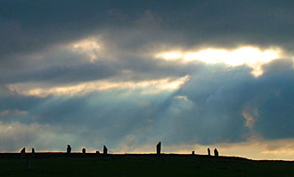
Radiocarbon dating puts it construction close to 2500-2000 BC, making it one of the last neolithic monuments. The stones have been compared to a band of giants lumbering under heavy weight across the landscape:


Source: http://www.orkneyjar.com/history/brodgar/index.html

Our appreciation for its mystery was somewhat hampered by the work underway to conserve the site. The snow fence is not part of the ancient henge:


As the sign notes, we followed the temporary path:


Carrie, our See Orkney tour guide, explained the details of the work going on:


It was rainy, so we avoided the muddy pathways. Greg is making his way across the turf: 


Nevertheless, the sheer size of the stones  was impressive and since the area around them is thought to have been a marshy fen at the time they were erected, the effort expended to transport and raise them is mind-boggling:


I wonder if there was heather 3,000 years ago!


Unlike the Standing Stones of Stenness, which in 1814 a tenant farmer began to knock over when he got tired of ploughing around them, the stones in this ring seem to have toppled for other reasons:


The sign explains how lightning cracked one of the stones: 


Incidentally the insensitive farmer was prevented from destroying any more of the Stenness stones and narrowly escaped having his house burnt down by his angry neighbours.

In 1906, the two henges (and other pre-historic sites) were taken into care by the government, the sites protected and studied and many fallen stones restored to their sockets.

(My source for much of this information: http://www.orkneyjar.com/history/index.html)

Wednesday 21 December 2016

Our tour of Orkney was a highlight of the trip

Re-reading my travel journal, I found this entry:

Sept. 9

We went on a tour with Carrie from See Orkney. It was well worth it! We saw all the Neolithic, Pict, and Viking sites as  well as Skalle (sic) House and the Italian Chapel, where a truck spring gave bounce to the baptismal font.

We ate lunch at a  brewery, which used to be a school – I had hot pot: beef, potatoes, turnips carrots. Again, not enough flavouring but still good on a cool windy day. I had soup as well – carrot and coconut. It was good too.


No dinner: we were still full from lunch – ate biscuits and had tea in our room and watched Father Brown

My rather abbreviated journal entry doesn't  do justice to the day. It actually began propitiously when at our typical Scottish breakfast, we were joined by a tiny surprise guest. Someone at the table spied movement on the floor, which we all first thought was a mouse. But no, it was a frog. It must have hopped in when Greg and I arrived in the dark the night before in the wind and rain. Clever amphibian preferred the heated floor of the solarium, where we were now eating breakfast, to the outdoor chill.

Someone at the table picked him up and set him outdoors  in the little walled garden just outside. I looked for him over the next couple of days, but I didn't see him again.

Carrie, our tour guide from See Orkney, arrived at the dot of 9:00, and off we went, the only passengers in her van. Carrie, pronounced as in car (not carry), was a wonderful host: she knew lots of stories about the area and the sites. She also kept us on time so we didn't have to worry about when to be anywhere, especially lunch, which she arranged for us at a pub/brewery.

There were of course sheep everywhere:


Here are some standing stones with sheep:


and no sheep:


and a shy sheep (just one):


Carie said that the standing stones were so prolific in years gone by that farmers used them as flagstones.

***

Our next stop was Skara Brae, a neolithic settlement inhabited between 3200 and 2200 BC. Eight prehistoric houses, connected by low passageways, have survived.The village was revealed by a massive winter storm in 1850, which not only gouged out the land around the village, but killed about 200 of the local people.


In the older part of the settlement, which probably never held more that 150 residents, the sleeping areas are little rooms off the main area:


Here is a passageway:


The view across Skaill Bay is rather unadorned:


Apparently this structure was a workshop , as described in the photo below this shot:


We were there on a rainy windy day. Glad I don't live in neolithic times, deerskins notwithstanding:


The later houses changed slightly and "became more rectangular with rounded internal corners. Also the beds were no longer built into the wall but protruded into the main living area."("http://www.orkneyjar.com/history/skarabrae/skarab1.htm)


The doorway seems a bit low; notice the rounded corners:


Here is the shoreline around Skaill Bay, probably not too much changed over the years, although erosion from storms is taking a greater toll now. 


***

After seeing Skara Brae, we warmed up a bit touring Skaill House, which Visit Scotland calls the "finest 17th Century mansion in Orkney." It was built in 1620 by Bishop George Graham, who was given the land after the execution of the previous land-owner, Patrick Stewart, 2nd Earl of Orkney, for treason in 1615. I mention this only because the 2nd Earl us a very distant relative of mine.

When  I (very quickly) realized that the Stewarts are still strongly disliked, I kept my pride at being related to this earl under heavy wraps. 

The southern wing of the house stands on a pre-Norse, likely Pictish, burial ground.

This link provides a fun account of the lives of Bishop Graham (who was removed from office for being soft on witchcraft and incest) and the various lairds who succeeded him:

http://skaillhouse.co.uk/the-house/the-lairds-of-skaill/  


This is the sunken garden at Skara Brae. The weather in the Orkneys is relatively moderate since, thanks to the Gulf Stream, it is on the same latitude (ca. 58 degrees) as the southern tip of Greenland. Often the flowers we saw were similar to those which flourish in PEI.


Skaill House was eventually home to the man who unearthed Skara Brae in 1850, William Graham Watt. According to information in the link below, he entertained Lady Jane Franklin, the wife of Sir John Franklin after the explorer left Stromness on his ill-fated voyage to find the Northwest passage (a Canadian connection in that Franklin's ships, the Erebus and the Terror were found in 2014 and 2016 respectively).  http://skaillhouse.co.uk/the-house/the-lairds-of-skaill/

I must confess I don't recall whom the portrait below memorializes. It might be Lord Watt. Captain James Cook's dinnerware is displayed at Skaill Hose, but the captain probably didn't linger long enough to have his portrait taken.  


***

Our next stop was Maeshowe, a 5,000 year old burial place, through the passageway of which the sun shines at the winter solstice. I hope, since it is December 21st today, that it is not overcast in Orkney. The entrance is at the white patch to the left.


Archeologists call it a "superlative monument." 


This is the walkway to the mound. Carrie told us that the powers- that-be are thinking of closing Maeshowe to the public because people have to cross a busy road to get to it and they are afraid of accidents. There must be better ways to solve that problem than closing the monument.


The passageway into the mound, lined up to greet the wintry sun, is 36 feet long.You have to walk doubled over and by the end, you feel very glad to be through it.


In about 1100-200 AD, Vikings found their way into the tomb, likely to pillage it, and left rune carvings on its walls. They called it the Mound of the Orks "Orkahaugr." (Graffiti were popular even then but are now considered to be very fine examples of runic writing.)

http://www.visitorkney.com/things/history/maeshowe


The Vikings weren't shy about boasting:


This graphic give a good idea of the elements of the mound:


***

At about then, it was time for lunch.  Now it is time for my 4:00 pre-suppertime break. I shall continue the story in my next blog.